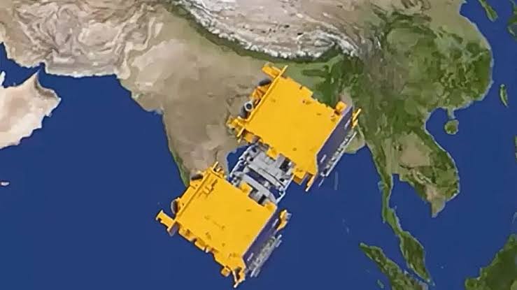
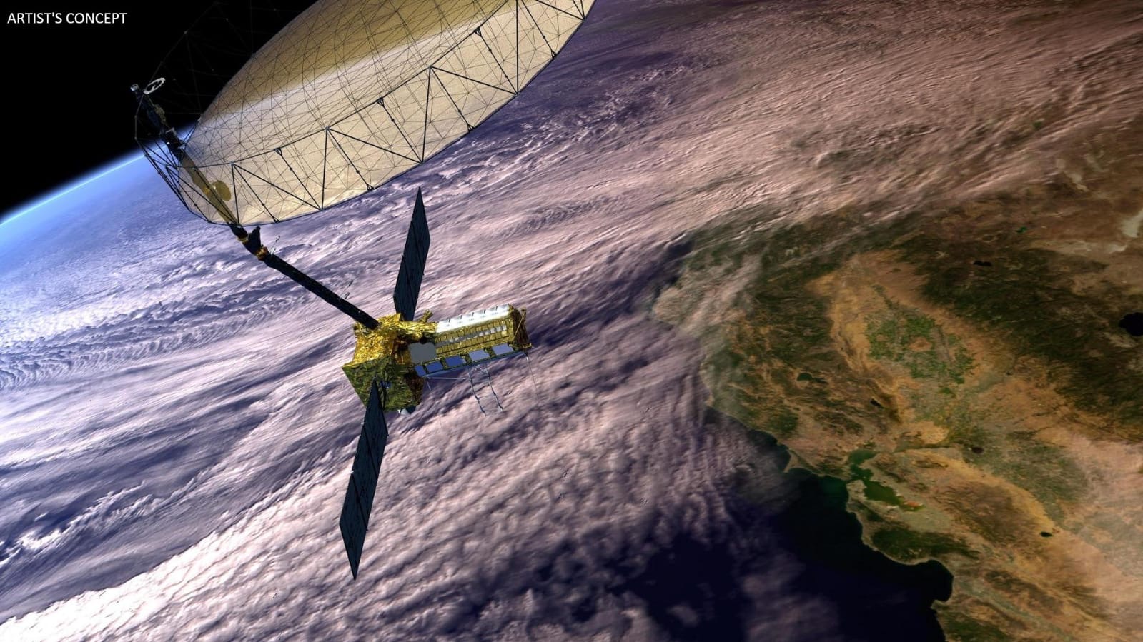
 An artist’s impression of the Nisar satellite orbiting Earth. (Image: Nasa)
New Delhi: The groundbreaking Nisar (Nasa-Isro Synthetic Aperture Radar) satellite mission successfully launched from the Satish Dhawan Space Centre in Sriharikota on Wednesday evening.
India’s Geosynchronous Satellite Launch Vehicle F16 (GSLV-F16) carried the Nisar satellite into space and successfully placed it in the orbit.
The Nisar satellite was successfully injected in the intended Sun Synchronous Polar Orbit (SSPO) at around 6pm IST, after a flight of about 19 minutes, 745 kilometres from the Earth’s equator.
The mission represents an unprecedented collaboration between the Indian Space Research Organisation and America’s National Aeronautics and Space Organization. The mission also highlights the growing strategic partnership between New Delhi and Washington in space exploration and Earth observation.
GSLV-F16/NISAR
— ISRO (@isro) July 30, 2025
Liftoff Rewind
Catch the liftoff visuals from GSLV-F16/NISAR launch. #NISAR #GSLVF16 #ISRO #NASA pic.twitter.com/umEyrBCF8T
Historic partnership takes flight
Nisar marks the first time Nasa and Isro have collaborated on hardware development for an Earth-observing mission.
This equal partnership brings together the technological expertise of both nations, with Nasa’s Jet Propulsion Laboratory in Pasadena, California, leading the American component while Isro’s UR Rao Satellite Centre in Bengaluru spearheads the Indian efforts.
The junior science and technology minister, Jitendra Singh, congratulated the scientists involved in mission and said it would be a “game changer”.
In a post on X, he said: “[The] successful launch of GSLV-F16 carrying the world’s first dual-band radar satellite Nisar is a game changer in precise management of disasters like cyclones, floods etc.
Also, its capacity to penetrate through fogs, dense clouds, ice layers, etc, makes it a pathbreaking enabler for aviation and shipping sectors.”
Earlier, before the launch, the US mission to India’s chargé d’affaires, Jorgan K Andrews, emphasized the mission’s significance in bilateral relations.
He noted that during their February meeting in Washington, US the president, Donald Trump, and the prime minister, Narendra Modi, highlighted space cooperation as a priority for the US-India relationship.
“Nisar, an unprecedented joint satellite mission between Nasa and Isro, marks a new chapter in the growing collaboration between our two space agencies,” Andrews stated.
Go NISAR! ?
— NASA (@NASA) July 30, 2025
The joint NASA-India satellite aboard @ISRO's Geosynchronous Launch Vehicle launched from the southeast Indian coast at 8:10am ET (1210 UTC) on its mission to monitor Earth's changing land and ice surfaces. pic.twitter.com/2Y3LUxlM2D
Advanced tech for Earth monitoring
The satellite is equipped with dual-band synthetic aperture radar technology, combining Nasa’s L-band SAR with Isro’s S-band SAR electronics.
This sophisticated radar system will penetrate cloud cover and operate day and night, which will provide continuous Earth-observation capabilities that optical satellites cannot match.
Nasa has contributed the radar reflector antenna, deployable boom, high-rate communication subsystem for science data, GPS receivers, solid-state recorder, and payload data subsystem.
Meanwhile, Isro’s Space Applications Centre in Ahmedabad has provided the S-band SAR electronics, with the agency also responsible for the spacecraft bus, launch vehicle, and mission operations.
How will NISAR support agriculture and farming?
— NASA JPL (@NASAJPL) July 30, 2025
Hear from the scientists and end users how its data will be used to map crop growth, track plant health, and monitor soil moisture. pic.twitter.com/glr9LWs9Py
Transformative applications for India
The mission holds particular significance for India’s agricultural and environmental monitoring needs.
Nisar’s advanced radar will map farmland from planting to harvest, providing crucial data for crop monitoring in a country where agriculture employs nearly half the population.
The satellite will also track critical infrastructure, monitor deforestation, and provide early warning systems for natural disasters.
The radar technology will enable precise measurement of ground movement, making it invaluable for monitoring seismic activity in earthquake-prone regions of the Himalayas and the Western Ghats.
Additionally, the mission will track wetland changes, crucial for water resource management in a country facing increasing water stress.
Technical specifications
Once operational, the satellite will orbit Earth every 12 days, providing comprehensive global coverage.
The mission’s synthetic aperture radar can detect changes in Earth’s surface as small as a few centimetres, making it one of the most sensitive Earth observation systems ever deployed.
The collaboration showcases India’s growing capabilities in space technology.
Since the successful Chandrayaan and Mangalyaan missions, Isro has established itself as a cost-effective and reliable space agency, attracting international partnerships.
The Nisar mission further cements India’s position as a key player in global space exploration and Earth-observation initiatives.